|
|
|
Index Index |
|
HISTORY OF MORRONE |
|
VARIED PAGES |
Morrone seen from: Poetri in morronese dialect |
Old photo album Current photo album Photos from viewers of the site Songs from Morrone Earthquake from Morrone My page I Miaban The Newspaper of Morrone |
|
THE MOLISE |
| The South and the Unification of Italy |
Exchange link Screen saver of Morrone ©COPYRIGHT |
| Apartment for rent |
| I am looking for Morronese relativen in America |
|
LA STORIA DI MORRONE |
|
VARIE |
Morrone visto da: La poesia dialettale |
|
MORRONE IERI E OGGI |
Raccolta foto antiche Raccolta foto recenti Canzoni morronesi foto inviate da Voi Il terremoto a Morrone Altri siti Molisani La mia pagina I Miaban Il Giornale di Morrone |
|
IL MOLISE E |
| IL SUD E L'UNITA'D' ITALIA |
Pagina link Screen saver di Morrone ©NOTIZIE SUL COPYRIGHT |
|
| info@morrone.com Webmaster & Admin Site: Giuseppe Buonviaggio |
|
|
|
|
|
|
||||
|
|
|||||
|
|
|
|
 Il comune informa


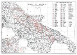
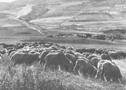
 The grazing route begins at the Biferno river in the
town of Pataffio
(anciently called Epitaffio pietra miliare) After having crossed Colle Bianco,
Colle Tentacalippo, Policarpio, one sees the roads for Castellino, S. Maria
Casalpiano and Petrella; one then passes by the possessions of the Colasurdo’s,
Colle Stefano, Vallone delle Lame and Colle dell’angelo, the road that leads
from Campobasso to Morrone and Cancello della Corte St., Puzzacchio St.,
Vallone Vaccareccia and Vallone Russino, which marks the border between
Morrone and Ripabottoni.
